"I'd like to say what an amazing recruitment agency this is. I had multiple agents contact me for a sales role but only a few were really listening to what I was looking for. George at Aaron Wallis was great, listened to what I was after and immediately got me an interview for a role I was interested in to which I accepted. Thank you for your help, I highly recommend this company."
Rob Norton, Candidate

Giving Back
Aaron Wallis Charity Challenges
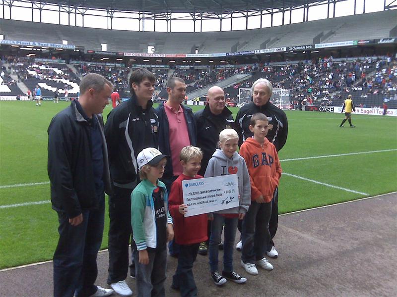
In the last seventeen years, our challenges have raised over £8.5K for several charities.
Charities supported include MK Dons Sport and Educational Trust and Breakthrough Breast Cancer. Our challenges have included:
2023 - Climbing Teide - the highest peak in Spain. It's actually in Tenerife!
2022 - South Downs Hike
2019 - Croatian Adventure - Kayaking the Zrmanja River, climbing Vaganski Vrh, hiking Plitvice and Krka National Parks
2018 - Icelandic Adventure - Climbing Hvannadalshnúkur, the highest peak in Iceland, together with trekking across several other peaks and glaciers.
2016 - Norwegian Two Peaks - the two highest peaks in Norway, including traversing the glacier of Galdhøpiggen.
2014 - Los Tres Picos - the three highest mountains in mainland Spain and The Infinity Run - a 100 mile run in 24 hours around Milton Keynes in the Bedfordshire and Buckinghamshire countryside in aid of St Francis Children's Society
2013 - The Great Glen Kayak Challenge from Fort William to Inverness across the Great Glen Fault in Scotland
On 31st May to 2nd June 2013 the team at Aaron Wallis undertook the Great Glen Kayak Challenge. This was an 86km challenge from Fort William on the West of Scotland to Inverness on the East Kayaking across the Great Glen Fault. Highlights included the Caledonian Canal, Loch Lochy, Loch Oich and of course, Loch Ness.
2012 – Milton Keynes Marathon, Climbing Toubkal (the highest mountain in the Atlas mountain range of North Africa), ascending every peak in Wales over 3000ft and The Jersey Challenge walking the 48.1 mile circumference of Jersey in under 14.5 hours
2011 – The Virgin London Marathon, the C2C or Coast to Coast bike ride and the Yorkshire Three Peaks
On June 10th, 30 members of the Aaron Wallis team, clients, suppliers, and friends cycled coast-to-coast across Northern England. Despite many of the team being in good shape already, cycling over hills was a real challenge! We thank everyone who sponsored our UK Three Peaks in 2010, raising over £2000 for MK SET.
2010 – The British Three Peaks and the Irish Three Peaks
On May 21st 2010, Aaron Wallis Sales Recruitment's team and their friends climbed the three highest peaks in England (Scafell Pike - 978m), Wales (Snowdon - 1085m), and Scotland (Ben Nevis - 1344m) in one weekend. Blessed with glorious weather, a guide at the top of Snowdon said it was the best visibility he’d ever seen in 72 ascents!
We loved it so much that we decided to scale the Irish Three Peaks on September 17, 2011, including Carrauntoohil (1,038m), Benkeeragh (1,010m), and Caher (1,001m).
Thanks to everyone who sponsored our UK Three Peaks, helping us raise over £2000 for MK SET, which provides young people with discipline, focus, and goals. Our fundraising significantly impacted MK SET's efforts, giving young people confidence and a sense of belonging. For more information, please visit the MK SET website.
View videos and images from our fundraising:
Great Glen Kayak 2013
Jersey Challenge 2012
Toubkal Challenge, Morocco, May 2012
Rob Scott's London Marathon 2011
C2C Charity Cycle Challenge 2011
Yorkshire 3 Peaks Challenge - July 2011
Irish Three Peaks - September 2010
Three Peaks - May 2010
MK Dons disability football fundraiser - June 2011

About the author
Rob Scott

Search jobs
With hundreds of jobs available, now is the time to look for your perfect position
Recruit sales staff
Just fill in your details below to get started

by Rob Scott
Managing Director